
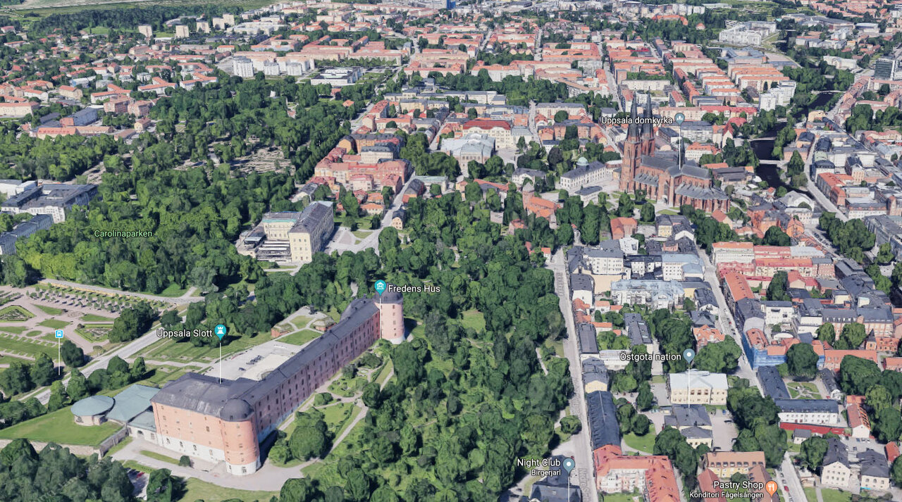
If you are into aerial photography, especially using a drone, then you know that it’s not easy to imagine how the world looks like from above. Composition from the air adds an extra dimension to usual level of photo composition difficulty. The most obvious choice would be to find a high point (hill, building etc) to get a sense of the landscape. When that is not good enough, we have Google Earth. Now for those of you who were paying attention to google maps, you might have noticed that google maps is now available in 3D. At least in some areas and major cities. For those areas, that are available, the level of detail is stunning. The views are far superior than the blocky 3D seen previously in Google Earth. I mean, just look at this:
This is so impressive. It looks like an open-world game. Every tree is rendered independently and probably has several thousand polygons. Now with 3D control, I can survey the area I want to photograph and compose my scene just the way I want. To show you some examples, below are some of the scenes composed in google maps and then actually photographed using a drone.
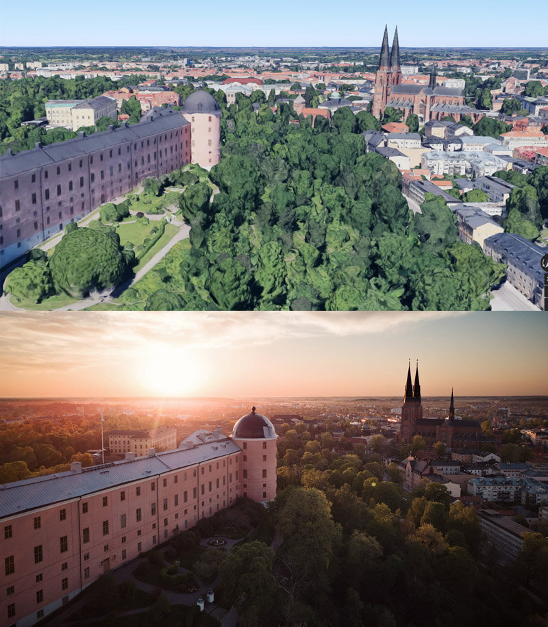
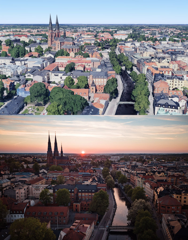
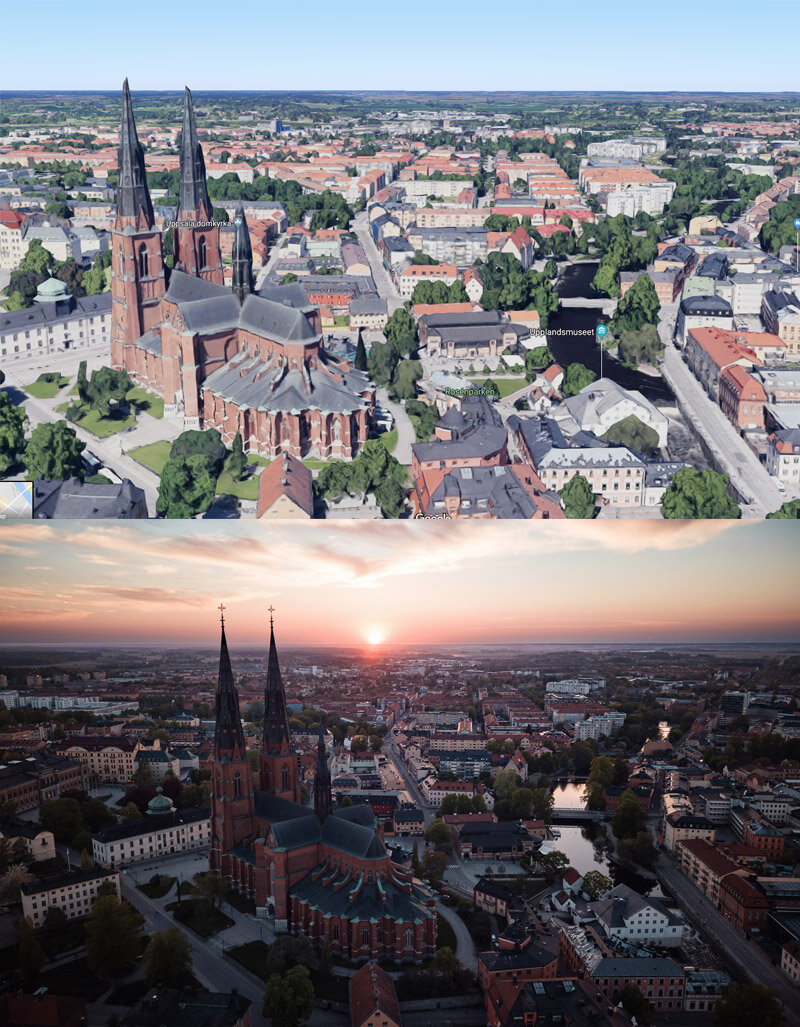
This is brilliant because I don’t need to use up a whole battery on my drone just to find a composition. The limitation is that this detailed 3D model is not available everywhere and also does not reflect the current lighting and weather conditions. It would also be great if google maps showed us the height of the viewpoint/camera when in 3D. Another useful additional would be to somehow incorporate SunCalc into this to get the position and trajectory of the sun.


Comments